
Pull to refresh
Logo
Deadly 7.7-magnitude earthquake hits Flores Sea near Ende, Indonesia

Deadly 7.7-magnitude earthquake hits Flores Sea near Ende, Indonesia

Built World

Quake triggered a tsunami warning and weeks of aftershocks; recovery in East Nusa Tenggara is just beginning

3 days ago: Aftershock count passes 9,700; USGS lists quake in monthly report

Overview

Updated 3 hours ago

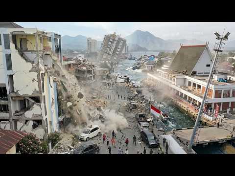
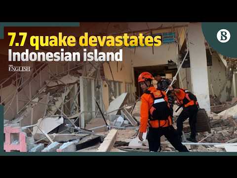
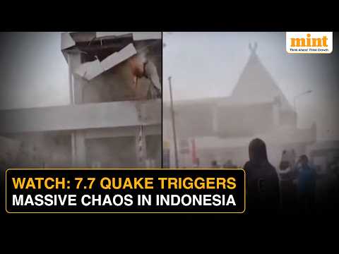
A magnitude 7.7 earthquake hit the Flores Sea before dawn on August 15, local time, 68 kilometers (42 miles) north-northwest of Ende, Indonesia. At least 47 people died, buildings collapsed across the region, and small tsunamis reached 16 coastal locations in four provinces.

The quake ruptured just 10 kilometers (6 miles) below the seafloor, shallow enough to amplify shaking across Flores and nearby islands. The US Geological Survey estimated roughly 2 million people felt strong to severe shaking. Indonesia's meteorological agency, BMKG, has recorded 9,765 aftershocks since, and rescue teams had not yet reached Nagekeo, the district closest to the epicenter.

Why it matters

A shallow quake in a densely populated, tsunami-prone region put roughly 2 million people in the shaking zone and tested Indonesia's tsunami warning system.

Questions about this story

Free account needed to ask — your question is kept and asked for you right after sign-up. Answers are public.

No questions yet — be the first to ask.

Key Indicators

7.7
Main shock magnitude
Struck at 10 km depth, 68 km NNW of Ende, on August 14, 2026 UTC.
9,765
Aftershocks recorded by BMKG
As of August 30; 155 were felt and the largest measured 6.1.
47+
Confirmed deaths
Officials expect the toll to rise as isolated districts are reached.
4,500+
Homes damaged
BNPB also counted 122 health facilities, 252 schools, and 84 places of worship damaged.
2 million
People in strong-to-severe shaking zone
USGS estimate of exposure to MMI VI-VIII shaking from the main shock.

Voices

Curated perspectives — historical figures and your fellow readers.

Ever wondered what historical figures would say about today's headlines?

Sign up to generate historical perspectives on this story.

Play

Exploring all sides of a story is often best achieved with Play.

Most of these play right now — no account needed. Sign up to save scores, keep a streak, and unlock Debate and Predict. Log in Sign Up
Predict 3 ways this could play out. Back the one you believe — contrarian picks score more when a scenario has a resolution date. Log in to play

People Involved

Organizations Involved

Timeline

7 events Latest: 3 days ago
Tap a bar to jump to that date
  1. Aftershock count passes 9,700; USGS lists quake in monthly report

    Latest Monitoring

    BMKG recorded 9,765 aftershocks by August 30, 155 felt, the largest at 6.1. The USGS published the event in its significant earthquakes listing.

  2. BNPB reports thousands of damaged buildings

    Damage assessment

    More than 4,500 homes, 122 health facilities, 252 schools, and 84 places of worship were damaged.

  3. Tsunami warning issued, then lifted

    Warning

    BMKG urged coastal residents to move to higher ground, then lifted the warning after tide gauges showed no major sea-level change. Small tsunamis still reached 16 locations.

  4. Death toll reaches at least 47

    Casualties

    Buildings collapsed across East Nusa Tenggara and power cuts disrupted communications, complicating rescue efforts.

  5. Landslides isolate Nagekeo, the district closest to the epicenter

    Access

    Road access was blocked by landslides and communications disrupted; a rescue team attempted to reach the area by ferry.

  6. M7.7 earthquake strikes Flores Sea near Ende

    Earthquake

    A shallow magnitude 7.7 quake hit 68 km NNW of Ende at 10 km depth, caused by reverse faulting.

  7. Strong aftershocks follow near Labuan Bajo and Ende

    Aftershock

    A magnitude 5.9 quake near Labuan Bajo and a 6.1 quake north of Ende hit shortly after the mainshock.

Historical Context

3 moments from history that rhyme with this story — and how they unfolded.

December 1992

Flores earthquake and tsunami (1992)

A magnitude 7.8 earthquake struck just 63 kilometers east-southeast of the August 2026 epicenter, off Flores Island's north coast. The quake generated a tsunami that destroyed tens of thousands of homes and killed at least 2,500 people.

Then

Entire coastal villages on Flores and nearby islands were destroyed, making it one of Indonesia's deadliest tsunamis of the 20th century.

Now

The 1992 disaster remains the reference point for tsunami risk in eastern Indonesia and underpins why authorities in 2026 issued a warning within minutes.

Why this matters now

The 2026 quake struck almost exactly where 1992 did. The parallel explains both the region's hazard and the speed of the warning response.

December 2004

Indian Ocean earthquake and tsunami (2004)

A magnitude 9.1 earthquake off Sumatra generated a tsunami that killed roughly 230,000 people across 14 countries, more than 160,000 of them in Indonesia. Waves reached coastlines within minutes, before any warning could be issued.

Then

The catastrophe revealed that the Indian Ocean had no tsunami warning system. Indonesia lost entire coastal communities in Aceh.

Now

It led to the Indian Ocean Tsunami Warning and Mitigation System and expanded Indonesia's network of tide gauges and seismic stations, including the tools BMKG used in 2026.

Why this matters now

The 2004 disaster is why a warning went out within minutes of the Flores quake, and why coastal residents moved to higher ground before the waves arrived.

September 2018

Palu earthquake and tsunami (2018)

A magnitude 7.5 earthquake struck near Palu on Sulawesi Island. BMKG issued a tsunami warning but lifted it within about 30 minutes; a tsunami still struck Palu Bay, killing more than 4,300 people.

Then

The Palu disaster raised sharp questions about the speed and accuracy of Indonesia's tsunami warnings and led to criticism and lawsuits against BMKG.

Now

BMKG revised its warning procedures and public messaging after Palu, though the fundamental challenge of detecting tsunamis within minutes remains.

Why this matters now

In August 2026, small tsunamis reached 16 locations after the warning was lifted. The Palu precedent shows why the decision to lift a warning carries real risk.

Sources

(10)