

Pull to refresh
Logo
M 6.7 earthquake shakes Peru's southern Andes

M 6.7 earthquake shakes Peru's southern Andes

Built World

Deep quake damages homes and clinics in Ayacucho; USGS and Peru's geophysical institute disagree on magnitude

August 21st, 2026: USGS issues Green alert for Aniso quake

Overview

Updated 1 hour ago

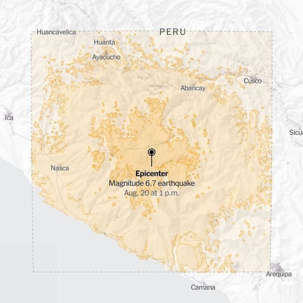
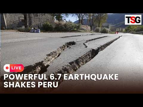
A magnitude 6.7 earthquake struck Peru's southern Andes on August 20, sending residents into the streets as far away as Lima, 480 km from the epicenter. The quake hit 31 km northwest of the small settlement of Aniso in the Ayacucho region at a depth of 99 km, injuring three people and damaging homes, schools, and health clinics.

The depth is the story. A 99 km hypocenter means the rupture's energy spread across a wide area instead of concentrating at the surface, which is why the US Geological Survey issued a Green alert — no fatalities expected. But Peru's Geophysical Institute recorded the same event at 7.2, a half-magnitude gap that changes how the quake is classified and how authorities calibrate their response.

Why it matters

Peru sits where the Nazca Plate dives under South America. This quake was deep enough to limit damage — the next may not be.

Questions about this story

Free account needed to ask — your question is kept and asked for you right after sign-up. Answers are public.

No questions yet — be the first to ask.

Key Indicators

6.7 (USGS) / 7.2 (IGP)
Reported magnitude
USGS logged 6.7; Peru's Geophysical Institute recorded 7.2 at 108 km depth.
99 km
Hypocenter depth
Intermediate depth spread shaking across regions but limited surface damage.
3
People injured
All three suffered minor injuries, per Defense Minister Rafael Belaunde.
22+
Homes damaged
Indeci later counted 33 homes affected across two provinces; three uninhabitable, one destroyed.
~9,000
Properties without power
Outages hit 6,023 users in Nazca province and 2,990 in Puquio district.

Voices

Curated perspectives — historical figures and your fellow readers.

Ever wondered what historical figures would say about today's headlines?

Sign up to generate historical perspectives on this story.

Play

Exploring all sides of a story is often best achieved with Play.

Most of these play right now — no account needed. Sign up to save scores, keep a streak, and unlock Debate and Predict. Log in Sign Up
Predict 3 ways this could play out. Back the one you believe — contrarian picks score more when a scenario has a resolution date. Log in to play

People Involved

Organizations Involved

Timeline

4 events Latest: August 21st, 2026 · 1 week ago
Tap a bar to jump to that date
  1. USGS issues Green alert for Aniso quake

    Latest Alert

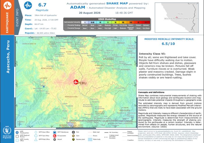
    PAGER Green: no fatalities expected. ShakeMap intensity VI at epicenter, V felt; about 11,000 people exposed to strong shaking.

  2. Damage tally emerges

    Assessment

    Officials report 3 injured, 22 homes and 6 schools damaged; 9,000 properties lose power; 12 health facilities hit.

  3. M 6.7 earthquake hits southern Peru

    Seismic Event

    Quake strikes 31 km northwest of Aniso, Ayacucho, at 99 km depth; felt across Peru including Lima, Cusco, and Arequipa.

  4. M 4.2 aftershock recorded

    Seismic Event

    Peru's Geophysical Institute logs a 4.2 aftershock about 3.5 hours after the main quake.

Historical Context

3 moments from history that rhyme with this story — and how they unfolded.

August 2007

Pisco earthquake (2007)

A magnitude 8.0 megathrust quake struck off Peru's central coast at about 40 km depth, collapsing buildings in Pisco and Ica and killing more than 500 people. The shallow rupture released energy directly beneath populated coastal cities.

Then

Pisco was largely destroyed and the government faced heavy criticism for a slow relief response.

Now

The disaster pushed Peru to strengthen building codes and disaster-response systems, though adobe construction remains widespread in the Andes.

Why this matters now

The 2026 quake's 99 km depth is why damage stayed limited. Depth is the difference between shaking and destruction — Pisco showed the shallow-end outcome.

January 2018

Acari earthquake (2018)

A magnitude 7.1 quake struck near Acari in Peru's Arequipa region at about 38 km depth, killing two people and injuring dozens. It was the strongest quake in southern Peru in years and damaged adobe homes across the region.

Then

Two deaths, dozens of injuries, and widespread damage to traditional earthen construction.

Now

The event highlighted how vulnerable unreinforced adobe homes remain in the Andes, a risk factor that persists today.

Why this matters now

Acari and Aniso sit on the same subduction zone where the Nazca Plate meets the South American Plate. The 2026 quake was deeper, which is why the toll was far lower.

August 2026

Colombia earthquake (2026)

Ten days before the Peru quake, a magnitude 7.4 earthquake struck Colombia, part of a string of deadly South American quakes that also included Venezuela, according to the BBC and USGS.

Then

Deaths and damage reported in Colombia; emergency responses activated across the region.

Now

The cluster underscores that the Pacific Ring of Fire is in an active seismic period across the Andes.

Why this matters now

The Peru quake came days after regional neighbors were hit, putting local authorities on alert and testing cross-border disaster coordination.

Sources

(9)