




Pull to refresh
Logo
M 6.9 earthquake strikes off Kamchatka's southern coast near Ozernovskiy

M 6.9 earthquake strikes off Kamchatka's southern coast near Ozernovskiy

Force in Play

Deep tremor near Ozernovskiy draws PAGER GREEN rating, signaling low expected impact

Yesterday: M 6.9 earthquake strikes near Ozernovskiy

Overview

Updated 2 hours ago

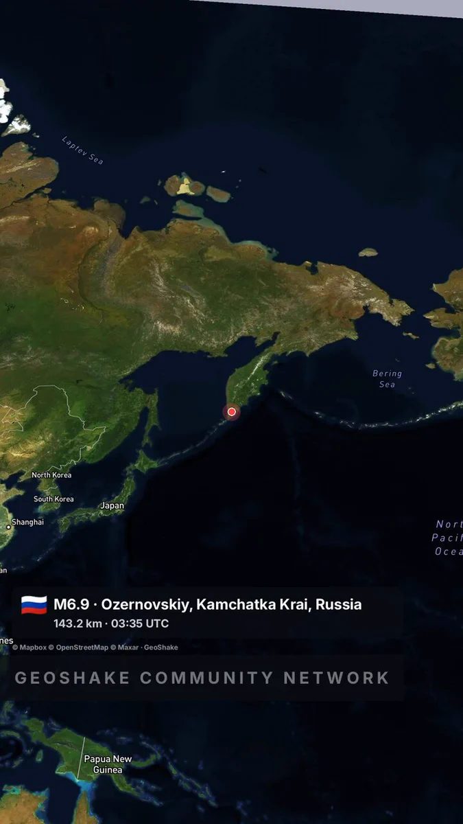
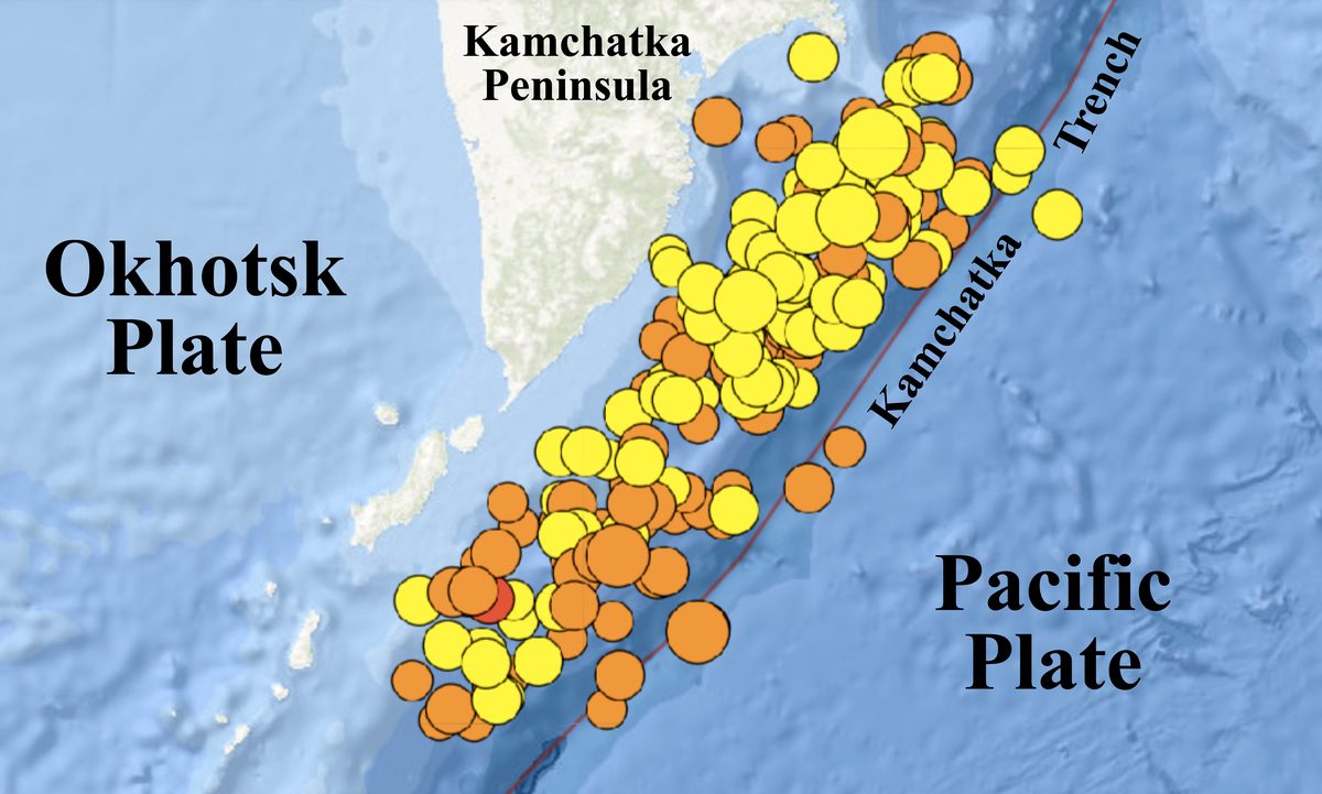
A magnitude 6.9 earthquake struck 76 kilometers northeast of Ozernovskiy, a small settlement on Kamchatka's southern coast, on October 15. The tremor originated 143 kilometers underground, inside the Pacific Plate slab diving beneath the peninsula.

The depth is why USGS rated the event low-risk. Its PAGER system, which estimates casualties and economic losses, issued a GREEN alert, while ShakeMap recorded strong (VI) shaking near the epicenter. The quake is the largest in a cluster across southern Kamchatka since early October, and it renews focus on a subduction zone capable of far larger, shallower ruptures.

Why it matters

Kamchatka's subduction zone just produced a magnitude 6.9 quake; deep events ripple near towns while larger, shallower ruptures remain the real risk.

Questions about this story

Free account needed to ask — your question is kept and asked for you right after sign-up. Answers are public.

No questions yet — be the first to ask.

Key Indicators

6.9
Earthquake magnitude
Moment magnitude reported by USGS for the October 15 event.
143 km
Depth
Hypocenter depth, placing the quake in the subducting Pacific slab.
GREEN
PAGER alert level
USGS fatality and loss estimate, indicating low expected impact.
VI
ShakeMap intensity
Strong shaking in the epicentral area on the Modified Mercalli scale.

Voices

Curated perspectives — historical figures and your fellow readers.

Ever wondered what historical figures would say about today's headlines?

Sign up to generate historical perspectives on this story.

Organizations Involved

Timeline

3 events Latest: Yesterday
  1. M 6.9 earthquake strikes near Ozernovskiy

    Latest Earthquake

    M 6.9 earthquake strikes 76 km northeast of Ozernovskiy at 143 km depth.

  2. M 5.2 tremor hits eastern Kamchatka coast

    Seismic activity

    M 5.2 tremor struck off the eastern Kamchatka coast at 10 km depth.

  3. M 4.6 quake recorded off Kamchatka

    Seismic activity

    M 4.6 earthquake recorded 96 km northeast of Ozernovskiy at 78 km depth.

Scenarios

1

Aftershocks rattle southern Kamchatka for weeks

Likely Resolves by Dec 15, 2026

Discussed by: USGS aftershock forecasting; historical pattern of Kamchatka sequences

Intermediate-depth earthquakes at 100-150 kilometers generate aftershock sequences that taper over weeks. The USGS and GS RAS catalogs will show whether further M 5+ tremors occur within 200 kilometers of the epicenter.

2

Larger shallow megathrust event follows in the Kuril-Kamchatka arc

Possible Resolves by Oct 15, 2027

Discussed by: Seismological literature on the region's seismic gap and recurrence of great earthquakes

The 1952 and 2006-2007 events show this trench can produce M 8+ ruptures. Whether the M 6.9 shifts stress on adjacent shallow fault segments is not established, but a shallow M 7.5+ within a year would match regional history. Monitoring continues.

3

Event resolves as isolated tremor with minimal impact, matching 2013 precedent

Likely Resolves by Nov 15, 2026

Discussed by: The 2013 M 6.9 off Ozernovskiy, which caused no significant damage

If aftershocks taper and no tsunami warning is issued, the M 6.9 becomes a routine, if large, intermediate-depth earthquake. Russian emergency services reporting no casualties or structural damage would complete the parallel to the 2013 event.

Historical Context

2 moments from history that rhyme with this story — and how they unfolded.

November 1952

1952 Severo-Kurilsk earthquake

A magnitude 9.0 megathrust earthquake ruptured the Kuril-Kamchatka trench on November 4, 1952. Tsunami waves up to 18 meters high struck Severo-Kurilsk on Paramushir island minutes later, leveling the town. More than 2,000 people were killed.

Then

Severo-Kurilsk was rebuilt on higher ground away from the harbor.

Now

The disaster pushed the Soviet Union to build and expand Pacific tsunami warning capabilities.

Why this matters now

It marks the catastrophic ceiling of this subduction zone: shallow megathrust quakes can push tsunamis ashore, unlike the deep October 2026 event.

February 2013

2013 M 6.9 off Ozernovskiy

A magnitude 6.9 earthquake struck 81 km southeast of Ozernovskiy on February 28, 2013, at 41 km depth. USGS rated it PAGER GREEN; people felt shaking at intensity IV in Petropavlovsk-Kamchatskiy.

Then

No significant damage or casualties were reported.

Now

The event joined the region's regular record of moderate, deep-to-intermediate earthquakes.

Why this matters now

Same magnitude, same area: the 2013 quake ended quietly, suggesting the 2026 event may follow a similar path.

Sources

(6)