Anchor

UN backs new world map that corrects Africa's distorted size
Rule ChangesGeneral Assembly votes 164-1 to promote equal-area projections over the 16th-century Mercator map
3 days ago: UN adopts 'Correct the Map' resolutionNew here? Follow stories to track developments over time. Create a free account to get updates when stories you care about change.
Overview
Updated 1 hour agoFor around 450 years, the standard world map made Africa look roughly the size of Greenland. On September 4, the United Nations General Assembly voted 164 to 1 to encourage schools, governments, and tech companies to show Africa's true dimensions.
The Mercator projection, designed in the 16th century for sailing, inflates land near the poles and shrinks land near the equator. Africa is about 14 times larger than Greenland. The non-binding resolution promotes equal-area maps like the Equal Earth projection, created in 2018.
Why it matters
Maps shape perception: a projection that shrank Africa for 450 years quietly influenced how the world sees the continent's scale and potential.
Questions about this story
Free account needed to ask — your question is kept and asked for you right after sign-up. Answers are public.
No questions yet — be the first to ask.
Key Indicators
164
UN member states voting in favor
Togo's resolution passed with overwhelming support from the General Assembly.
1
votes against (United States)
The US called the measure part of a radical ideological project.
6
abstentions
Estonia, Georgia, Lithuania, Moldova, Serbia, and Ukraine abstained.
14x
Africa's real size relative to Greenland
Mercator makes them look similar even though Africa is about 14 times larger.
Related Media
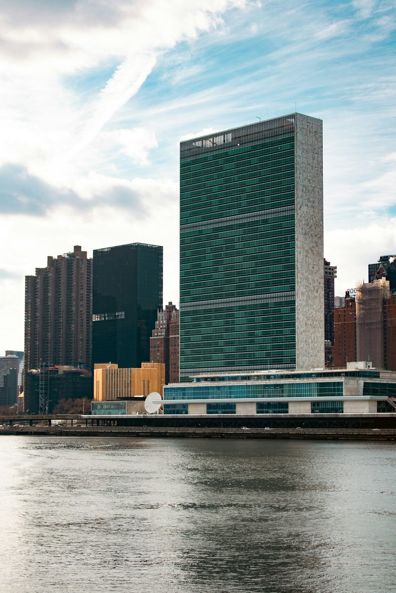
The United Nations Headquarters in New York City, seen from across the East River. The tall, glass-faced Secretariat Building stands prominently, embodying modernist architectural design. At its base lies the General Assembly Building, a horizontal structure where representatives from around the world convene. This iconic complex, situated in Midtown Manhattan, serves as a global hub for diplomacy and international policy. The waterfront view highlights the UN’s presence as both a political and architectural landmark in New York City.
![World Mercator map projection with true country size and shape added [OC] : r/dataisbeautiful](/api/story/3919/photo/4949)
World Mercator map projection with true country size and shape added [OC] : r/dataisbeautiful
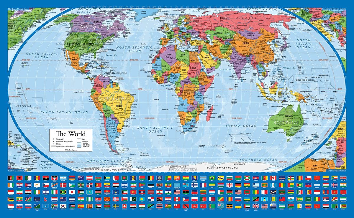
Amazon.com : Equal Earth World Map Poster - map design shows continents at true relative size. (LAMINATED, 18” x 29”) : Office Products
Images from Openverse under Creative Commons licenses.
Voices
Curated perspectives — historical figures and your fellow readers.
Play
Exploring all sides of a story is often best achieved with Play.
Most of these play right now — no account needed. Sign up to save scores, keep a streak, and unlock Debate and Predict.
Log in
Sign Up
Higher or Lower
A number from this story, against one from elsewhere in the news — guess which is bigger, then keep the chain going. 5 rounds, 3 strikes; a miss costs a strike and resets your streak.
Example
Anchor
EU tariff revenue
$52B
Big for this kind of number
Mystery
Pentagon AI contract
?
Round 1
Streak: 0
Mystery
?
Keyboard: ↓/L lower · ↑/H higher
0 pts
Best streak: 0 · Rounds: 0
0 points — sign up to put that on the leaderboard.
Now try on this story
Connections
Sixteen names from the news. Find the four hidden groups of four. Four mistakes max.
Loading today's puzzle…
0/4 groups
Mistakes
Sign up to keep a daily streak — a new puzzle lands every day.
Now try on this story
Exit debate?
Your progress in this debate will be lost.
How it works
- 1 Two AI personas square off on this story.
- 2 You predict who'll win each round — correct picks earn XP.
- 3 One crossfire question is yours to fire. Pick it carefully.
Couldn't generate a topic
Select Your Champions
Choose one persona for each side of the debate
DEBATE TOPIC
Choose personas with different perspectives for a more dynamic debate.
SIDE A (PRO)
Select debater for this side:
No debate personas available right now.
SIDE B (CON)
Select debater for this side:
No debate personas available right now.
VS
Get ready to make your prediction...
Round of
Claim
Evidence
Stakes
Crossfire Answer
Closing Statement
Claim
Evidence
Stakes
Crossfire Answer
Closing Statement
Your Crossfire Question
Generating arguments...
Who's Got This Round?
Make your prediction before the referee scores
The referee scores both sides on
Correct predictions earn +20 XP
· Press 1 or 2 to pick
Evidence
40%
Logic
30%
Detail
20%
Style
10%
Round Results
Your Pick
Not this time
(%)
Overall Score
/10
Your Pick
Not this time
(%)
Overall Score
/10
Set the Crossfire
Pick the question both personas must answer in the final round
Crafting crossfire questions...
Choosing a question earns +10 XP crossfire bonus
🏆
Total XP Earned
Cred Change
Predictions
Debate Oracle! You called every round!
Sharp Instincts! You know your debaters!
The Coin Flip Strategist! Perfectly balanced!
The Contrarian! Bold predictions!
Inverse Genius! Try betting the opposite next time!
XP Breakdown
Base completion
+20 XP
Rounds played ( rounds x 5 XP)
+ XP
Correct predictions ( correct x 20 XP)
+ XP
Crossfire bonus
+10 XP
Accuracy
%
Prediction History
Round
You picked:
✓
✗
Now try on this story
Keep debating to level up your credibility and unlock achievements
People Involved
Faure Gnassingbé
President of Togo
Championed the 'Correct the Map' resolution
Mahmoud Ali Youssouf
Chairperson of the African Union Commission
Welcomed the resolution's adoption
Jean-Noël Barrot
France's minister for Europe and foreign affairs
Announced France would drop Mercator for its world maps
Organizations Involved
United Nations General Assembly
International body
Adopted resolution A/80/L.104
The UN's main deliberative body, representing all 193 member states.
African Union
Continental political union
Champion of the resolution
The 55-member continental body that backed the African-led campaign.
Republic of Togo
UN member state
Sponsored the resolution
West African nation that led the cartographic reform campaign.
United States delegation
National delegation
Sole vote against the resolution
The only UN member state to oppose the map resolution.
Timeline
January 1569 September 2026
6 events
Latest: 3 days ago
Tap a bar to jump to that date
-
UN adopts 'Correct the Map' resolution
Latest VoteGeneral Assembly votes 164-1 to encourage equal-area map projections.
-
Informal consultations on the draft
DiplomacyUN General Assembly holds informal talks on the 'Correct the Map' resolution.
-
Togo brings the issue to the UN
DiplomacyTogo asks UN member states to consider adopting equal-area maps.
-
African Union adopts Equal Earth map
PolicyThe AU's 54 member states endorse the projection over Mercator.
-
Equal Earth projection released
HistoricalCartographers create an equal-area map preserving relative continent sizes.
-
Mercator publishes his world map projection
HistoricalGerardus Mercator's navigation map becomes the standard; it distorts land sizes.
Historical Context
3 moments from history that rhyme with this story — and how they unfolded.
October 1884
International Meridian Conference (1884)
Delegates from 25 nations voted to make Greenwich the prime meridian, the world's zero point for longitude. The choice favored the British Empire, which controlled the maritime routes the line served.
Then
Greenwich became the basis for global time zones and navigation standards.
Now
The conference showed that decisions about global geographic representation are made by political power, not neutral science.
Why this matters now
Like the 1884 vote, the 2026 map resolution is a political decision about how the world is represented, with real consequences for how regions are perceived.
1974-1980s
Gall–Peters projection debate (1974)
German historian Arno Peters presented an equal-area map showing Europe far smaller than on Mercator. He argued the familiar projection inflated Europe's apparent importance. Cartographic societies spent over a decade contesting the claims.
Then
Major publishers and aid agencies adopted the Peters map, and the debate dominated geographic conferences for years.
Now
It established that map choice is political, not just technical, and pushed publishers to disclose projection limitations.
Why this matters now
The 1974 dispute previewed today's argument that Mercator is a tool of cognitive distortion, not a neutral view of the world.
October 2010
Kai Krause's 'The True Size' map (2010)
Designer Kai Krause released a viral graphic fitting all the world's countries inside Africa's borders. The image, with data verified by the UN's cartographic office, showed Africa's 30 million square kilometers dwarf every other landmass.
Then
The graphic spread across the internet and appears in classrooms worldwide.
Now
It turned the size distortion into public knowledge and built popular demand for accurate maps.
Why this matters now
Krause's image is the cultural taproot of the campaign that ended in the UN vote; it made the Mercator distortion tangible to millions.
Sources
(8)Related Stories
Israel recognizes Somaliland, shattering 34-year diplomatic freeze
Rule Changes
Updated May 16
International governance of artificial intelligence
Rule Changes
Updated May 29
Earth gained 2.24 million square kilometers of tree cover in 35 years
Built World
Updated May 22
Guinea-Bissau expands presidential powers in referendum backed by military government
Rule Changes
Updated 3 days ago
AGOA trade program extended amid uncertainty over US-Africa relations
Rule Changes
Updated May 27
Davos 2026: record leaders gather as US-Europe rift deepens
Rule Changes
Updated May 22