


Pull to refresh
Logo
Daily Brief
Following
Why Ranks Sign Up
Africa Mining Watch trains journalists to spot illegal mines from space

Africa Mining Watch trains journalists to spot illegal mines from space

New Capabilities

A Pulitzer Center, Code for Africa and Earth Genome tool brings satellite AI to extractives reporting across the Congo Basin

July 2026: Planned public launch

Overview

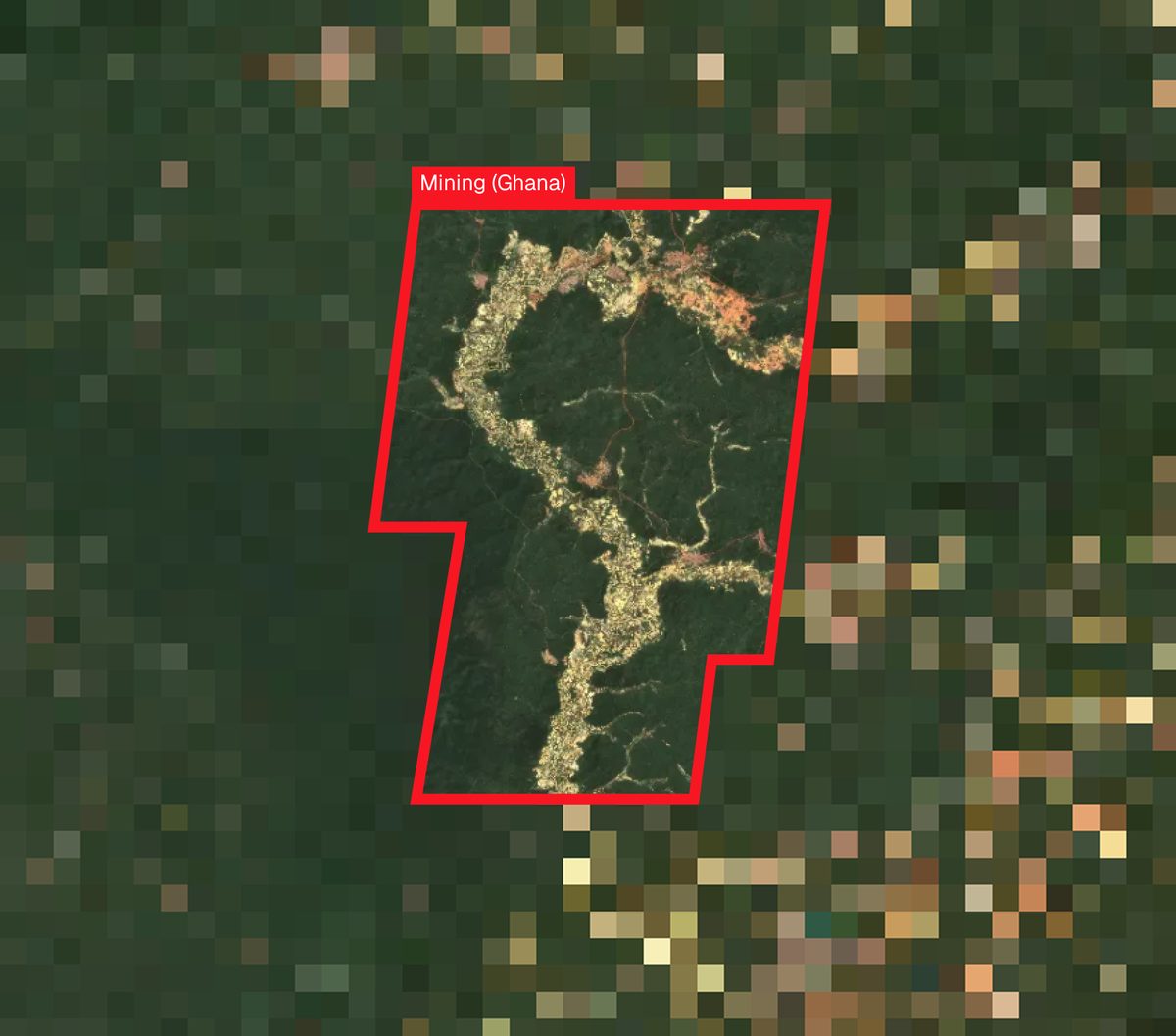
Spotting a fresh mining pit in the Congo Basin used to take months of ground reporting and a small fortune in plane tickets. On April 22, about 25 African journalists logged into an online mapathon and learned to find one in minutes, using Sentinel-2 satellite imagery and a machine-learning model trained to recognize the bare-earth scar of an open pit.

The training is the soft launch of Africa Mining Watch, a tool built by the Pulitzer Center, Code for Africa and Earth Genome. A public release is planned for July. The platform copies the playbook of Amazon Mining Watch, which has already fed investigations into illegal gold mining published in Brazil, Spain, Venezuela and the United States.

Why it matters

Reporters covering Congo Basin mining can now see new pits the week they appear, not months later when communities finally complain.

Key Indicators

25
Journalists trained
African reporters joined the Earth Day mapathon, most of them already covering mining.
3
Partner organizations
Pulitzer Center, Code for Africa and Earth Genome built the tool together.
July 2026
Public launch
Open-source release planned to follow the journalist training period.
9
Countries on the predecessor
Amazon Mining Watch covers all nine Amazonian countries; the Africa build aims for similar continental scope.

Voices

Curated perspectives — historical figures and your fellow readers.

Ever wondered what historical figures would say about today's headlines?

Sign up to generate historical perspectives on this story.

Play

Exploring all sides of a story is often best achieved with Play.

Log in to play. Track your picks, climb the leaderboards. Log in Sign Up
Predict 4 ways this could play out. Contrarian picks score more — points lock when the scenario resolves. Log in to play
Higher or Lower Two numbers from this story. Guess which is bigger. 5 rounds to set a streak. Log in to play
Timeline Five events from this story — drag them oldest to newest. Log in to play
Connections Sixteen names from the news. Find the four hidden groups of four. Log in to play

Organizations Involved

Timeline

October 2022 July 2026

5 events Latest: July 2026
Tap a bar to jump to that date
  1. Planned public launch

    Latest Milestone

    Partners say africaminingwatch.org will open to the public, with detection layers and an open data download.

  2. Earth Day mapathon trains 25 African journalists

    Training

    Reporters from across the continent join an online mapathon. Earth Genome staff walk them through reading satellite tiles and flagging suspected mines.

  3. Africa Mining Watch partnership announced

    Announcement

    Code for Africa publishes the partnership announcement with the Pulitzer Center and Earth Genome on Medium.

  4. Amazon platform moves to quarterly updates

    Capability

    Amazon Mining Watch begins near-real-time quarterly detection of new gold-mining fronts, proving the model can run at production cadence.

  5. Amazon Mining Watch launches

    Precedent

    Earth Genome, Amazon Conservation and the Pulitzer Center release the first AI-driven public map of gold-mining deforestation across all nine Amazonian countries.

Historical Context

3 moments from history that rhyme with this story — and how they unfolded.

October 2022

Amazon Mining Watch launch (2022)

Earth Genome, Amazon Conservation and the Pulitzer Center's Rainforest Investigations Network released the first AI-driven public map of gold-mining deforestation across all nine Amazonian countries. The site used a convolutional neural network on Sentinel-2 imagery to flag suspected pits at ten-meter resolution.

Then

Within two years, reporters used the data to publish investigations in Brazil, Spain, Venezuela and the United States, several focused on mining inside Indigenous reserves.

Now

The platform moved to quarterly updates in 2025 and became a standard reference for Amazon environmental coverage, including by Mongabay and MAAP.

Why this matters now

Africa Mining Watch is a direct port of this project with the same lead engineering team. The Amazon timeline is the best guide to what the Africa version is likely to produce and when.

February 2014

Global Forest Watch launch (2014)

The World Resources Institute launched Global Forest Watch with Google, the University of Maryland and about 40 other partners. It put near-real-time deforestation alerts on a public web map, built on Landsat imagery and the Hansen forest-loss dataset.

Then

Within a year, governments in Indonesia and Peru and NGOs in the Congo Basin used the alerts to direct enforcement and reporting. Newsrooms cited the data in dozens of investigations.

Now

Global Forest Watch became permanent reference infrastructure for environmental reporting and accountability, with more than three million users by 2024.

Why this matters now

It is the closest analog for what Africa Mining Watch is trying to be: a public, satellite-driven dataset that both watchdogs and reporters can plug into. Adoption was rapid once the data was free and clickable.

2014 onward

Bellingcat and the rise of open-source satellite reporting (2014 onward)

Eliot Higgins founded Bellingcat in 2014. The team used commercial satellite imagery and social-media geolocation to reconstruct the downing of Malaysia Airlines Flight 17 and later mapped Russian forces in eastern Ukraine and Syria.

Then

Bellingcat investigations were cited by the Dutch Safety Board and the Joint Investigation Team that indicted suspects in the MH17 case.

Now

Open-source intelligence using satellite data became a standard method in investigative journalism, with units at the New York Times, BBC and Reuters.

Why this matters now

Africa Mining Watch tries to do for environmental reporters what Bellingcat did for conflict reporters: turn satellite imagery from a specialist resource into an everyday newsroom tool.

Sources

(7)