


Pull to refresh
Logo
Hurricane Isaias nears Gulf Coast landfall with surge and wind warnings in effect

Hurricane Isaias nears Gulf Coast landfall with surge and wind warnings in effect

Force in Play

The Category 2 storm is 230 miles south of the Mississippi River mouth and expected to make landfall Friday night or early Saturday.

Today: Advisory 9A confirms warnings in effect

Overview

Updated 2 hours ago

Hurricane Isaias is hours from a Gulf Coast landfall. At 1 a.m. Friday, the Category 2 storm was 230 miles south of the Mississippi River's mouth, moving northeast at 14 mph.

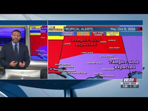
Storm surge warnings run from the Mississippi River mouth to Florida's Suwannee River. Hurricane warnings run from Ocean Springs, Mississippi, to the Bay/Gulf county line in Florida. The National Hurricane Center expects landfall Friday night or early Saturday, with possible brief strengthening to Category 3 before it hits.

Why it matters

Life-threatening storm surge and hurricane-force winds threaten the Gulf Coast from Mississippi to Florida within the next 24 hours.

Questions about this story

Free account needed to ask — your question is kept and asked for you right after sign-up. Answers are public.

No questions yet — be the first to ask.

Key Indicators

105 mph
Maximum sustained winds
Category 2 intensity in the 1 a.m. advisory, up from 100 mph six hours earlier.
972 mb
Minimum central pressure
Falling pressure over recent advisories points to a strengthening system.
375 km
Distance from Mississippi River mouth
The center was 230 miles (375 km) south of the river mouth at 1 a.m.

Voices

Curated perspectives — historical figures and your fellow readers.

Ever wondered what historical figures would say about today's headlines?

Sign up to generate historical perspectives on this story.

People Involved

Organizations Involved

Timeline

4 events Latest: Today
Tap a bar to jump to that date
  1. Advisory 9A confirms warnings in effect

    Today Warning

    Storm at 24.9N, 88.8W with 100 mph winds; hurricane and storm surge warnings cover the northern Gulf Coast.

  2. Advisory 10 lifts intensity to 104 mph

    Today Intensification

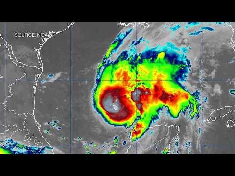
    Satellite images show the eye organizing; NHC raises intensity to 90 kt and notes some models show a brief Category 3 peak.

  3. Advisory 10A: hunters in the storm, 105 mph winds

    Today Advisory

    Storm at 25.8N, 88.4W, pressure 972 mb, 230 miles from the Mississippi River; both NOAA and Air Force crews aboard.

  4. Advisory 9 places storm at 100 mph

    Advisory

    The NHC puts Isaias at 24.4N 89.3W with 85-knot winds (100 mph), moving northeast.

Scenarios

1

Isaias makes landfall as a Category 3 hurricane

Unlikely Resolves by Oct 12, 2026

Discussed by: NHC discussion and ensemble models showing a brief Category 3 peak

The NHC forecast peaks Isaias at 115 mph around midday Friday. Then southwesterly shear from an approaching trough is expected to weaken it before landfall. A Category 3 landfall would require that shear to arrive later than modeled, which no major forecast currently projects.

2

Category 2 landfall, as forecast

Likely Resolves by Oct 12, 2026

Discussed by: NHC official forecast

The NHC expects Isaias to come ashore Friday night or early Saturday with 100 mph winds, a Category 2, within the hurricane warning area from Ocean Springs, Mississippi, to the Bay/Gulf county line in Florida. The storm weakens to tropical storm strength within 12 hours of moving inland.

3

Early shear weakens Isaias before landfall

Possible Resolves by Oct 12, 2026

Discussed by: NHC Discussion 10, noting shear increases considerably Friday

The NHC warns that southwesterly shear from an upper-level trough will build through Friday. If it arrives sooner than expected, Isaias could weaken to Category 1 or below before crossing the coast. The storm would still deliver tropical-storm-force winds, heavy rain, and surge, but the most destructive wind impacts would be reduced.

Historical Context

3 moments from history that rhyme with this story — and how they unfolded.

October 2018

Hurricane Michael (2018)

Michael was a Category 5 hurricane that hit the Florida Panhandle near Mexico Beach on October 10, 2018. It came ashore with 160 mph winds, the strongest landfall on record for that part of Florida.

Then

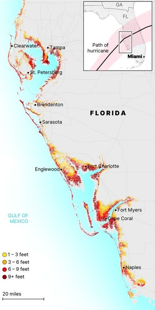
The storm flattened much of Mexico Beach and surrounding towns, with storm surge measured along a wide stretch of coast.

Now

Michael's rapid strengthening and high-end intensity raised questions about how quickly such storms can intensify near land.

Why this matters now

Isaias is approaching the same coastline, though it is forecast to be far weaker than Michael was at landfall.

August 2021

Hurricane Ida (2021)

Ida strengthened from a tropical storm to a Category 4 hurricane in about a day. It hit southeastern Louisiana on August 29, 2021, with 150 mph winds, sixteen years after Katrina.

Then

Ida knocked out power to much of New Orleans and caused severe flooding across the region from heavy rain.

Now

The storm made rapid intensification before landfall a focus of NHC forecasts and public messaging.

Why this matters now

Like Ida, Isaias is expected to strengthen in the final day before a Gulf landfall, a pattern that can shift impacts at the last moment.

July-August 2020

Hurricane Isaias (2020)

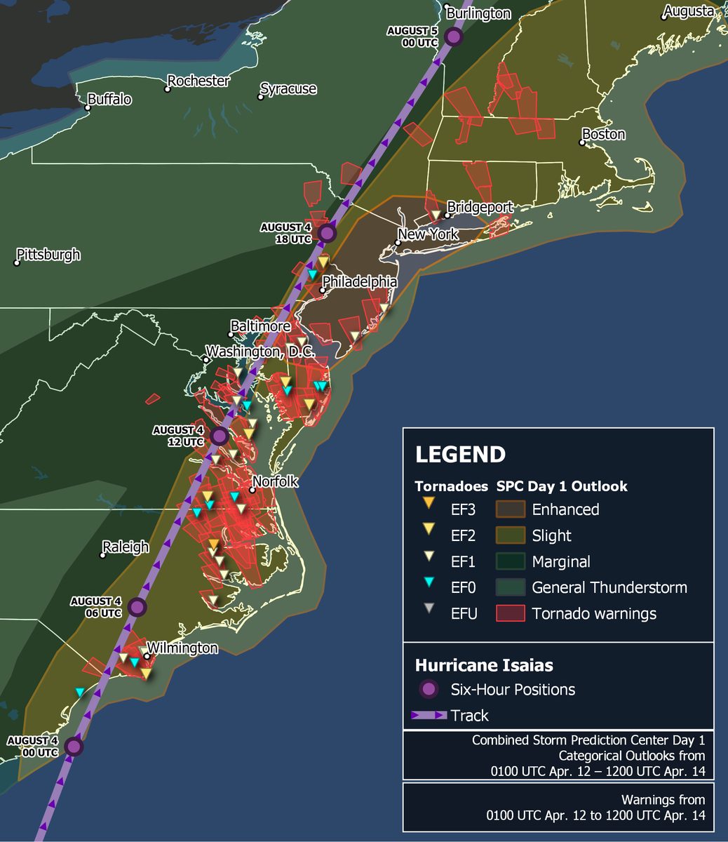
The 2020 storm with this name was a Category 1 hurricane that hit near Ocean Isle Beach, North Carolina, on August 4, 2020, then raced up the East Coast. The name was not retired, so it returns on the six-year Atlantic list in 2026.

Then

The 2020 storm brought wind damage, tornadoes, and flooding from the Carolinas to New England.

Now

Its name stayed on the Atlantic list, reserving Isaias for the 2026 season.

Why this matters now

The 2026 Isaias is stronger than its namesake and is taking a Gulf Coast path instead of an East Coast one.

Sources

(6)