
Pull to refresh
Logo
Reveal Technology launches Farsight 2.0, fusing drone and satellite imagery into one terrain model

Reveal Technology launches Farsight 2.0, fusing drone and satellite imagery into one terrain model

New Capabilities

Global world model lets Army units share terrain intelligence across command networks

Yesterday: Farsight 2.0 launches with global world model

Overview

Updated 49 minutes ago

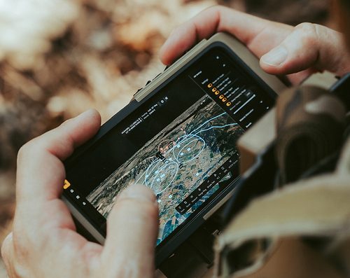
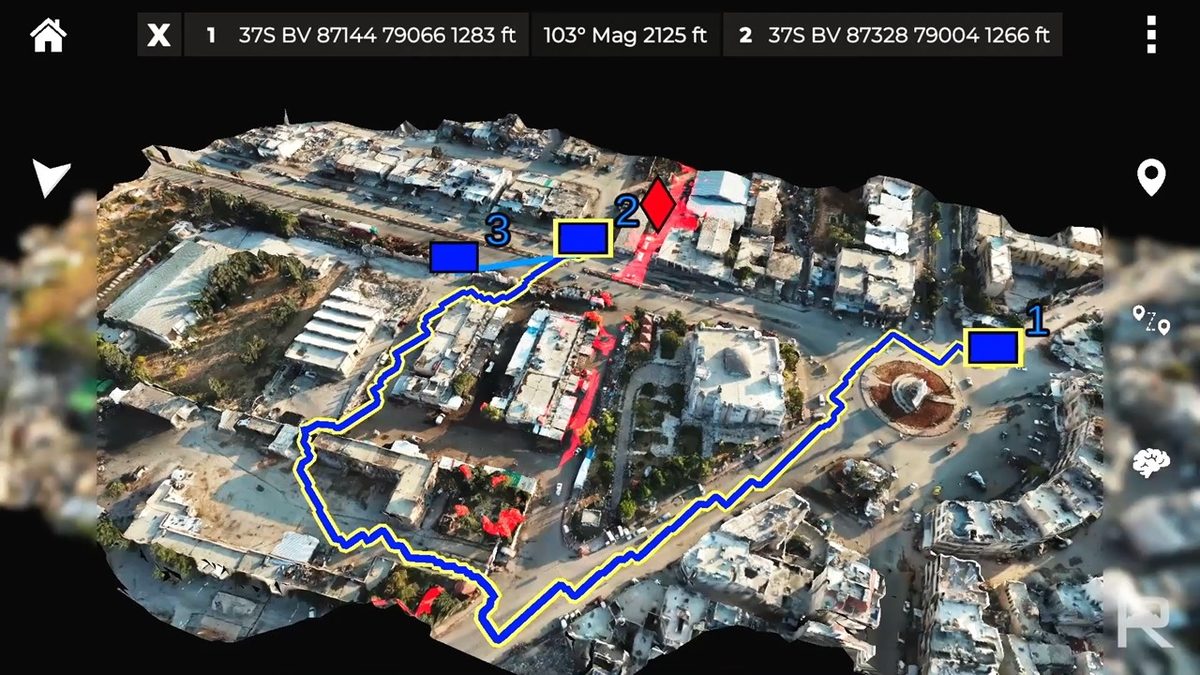
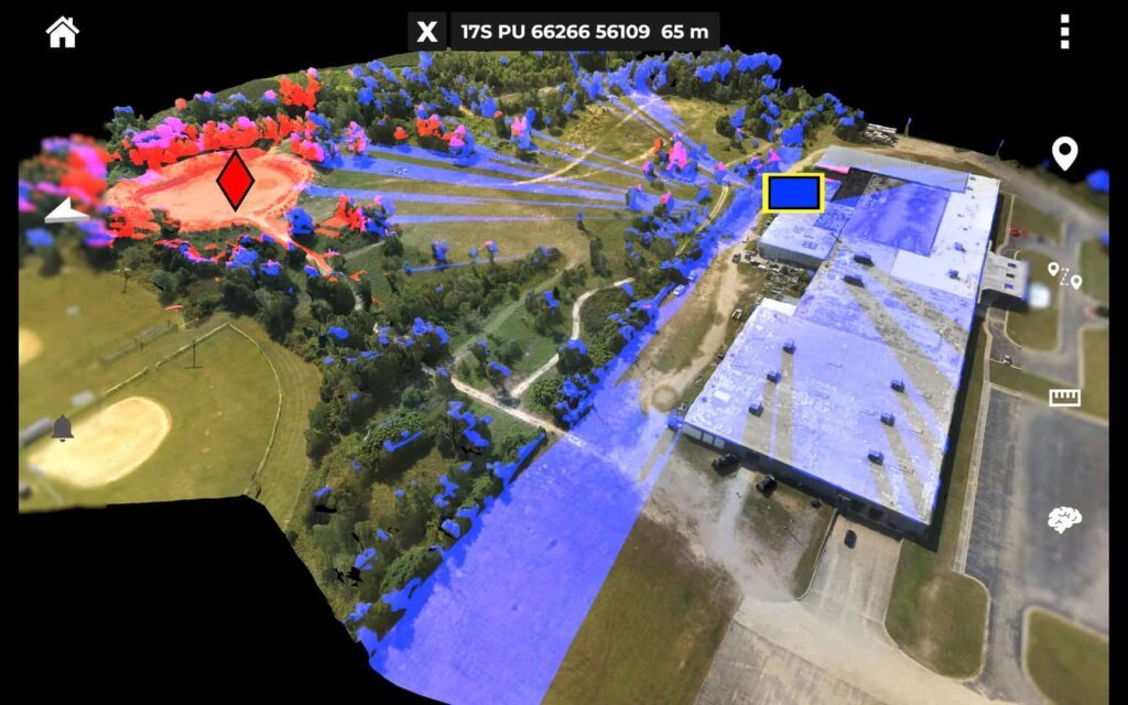
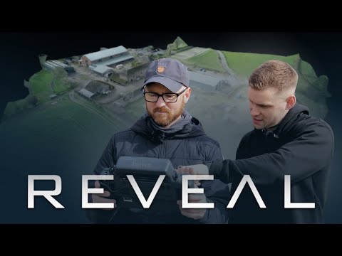
Reveal Technology launched Farsight 2.0 on October 12, a 3D mapping platform that fuses drone, satellite, and sensor imagery into one continuously updated terrain model. The update means Army units no longer depend on what they can collect themselves—every authorized source feeds the same picture.

The launch comes with a $9.5 million Army purchase order for additional infantry brigades. The platform runs on hardware soldiers already carry and integrates with Nett Warrior, the Army's soldier-worn situational awareness system.

Why it matters

Farsight 2.0 gives frontline units a shared, current terrain picture from every authorized source—cutting the time between collecting imagery and acting on it.

Questions about this story

Free account needed to ask — your question is kept and asked for you right after sign-up. Answers are public.

No questions yet — be the first to ask.

Key Indicators

$9.5M
Army purchase order
Second delivery order under GSA IDIQ contract for additional infantry brigades.
20+
Partner nations using Farsight
U.S. forces and more than 20 partner nations use the platform.
2 min
Time to process UAS data into 3D model
Farsight processes drone data into a maneuver-quality 3D model in as little as two minutes.

Voices

Curated perspectives — historical figures and your fellow readers.

Ever wondered what historical figures would say about today's headlines?

Sign up to generate historical perspectives on this story.

People Involved

Organizations Involved

Timeline

May 2025 October 2026

3 events Latest: Yesterday
  1. Farsight 2.0 launches with global world model

    Latest Product Launch

    Reveal launched Farsight 2.0, fusing drone, satellite, and sensor imagery from all available sources into one continuously updated terrain model.

  2. Army places $9.5 million Farsight order

    Contract

    Reveal announced a $9.5 million U.S. Army purchase order under its GSA IDIQ contract for additional infantry brigades.

  3. Reveal and Maxar announce satellite imagery partnership

    Partnership

    Reveal announced an option to use Maxar satellite imagery and 3D data as a basemap for Farsight.

Scenarios

1

Army expands Farsight 2.0 to more brigades

Likely Resolves by Oct 12, 2027

Discussed by: Reveal Technology, U.S. Army PEO Soldier

The $9.5 million order supports procurement, distribution, training, and sustainment for additional infantry brigades. If fielding goes smoothly, the Army could expand Farsight 2.0 to more units, building on the existing user base and the platform's integration with Nett Warrior.

2

Adoption stalls on data-sharing or security hurdles

Possible Resolves by Oct 12, 2027

Discussed by: moneymakers.com noted the release doesn't document completed installations or performance results

The global world model requires sharing imagery across command and control networks. Security or interoperability issues could slow adoption, especially if units face challenges integrating with existing systems or if the Army requires additional security certifications.

3

Competitors launch similar global world models

Possible Resolves by Oct 12, 2027

Discussed by: SpaceNews, dronearticles.com

Other defense tech companies may respond with similar capabilities, creating competition in the tactical mapping space. This could push prices down or accelerate feature development across the industry.

Historical Context

2 moments from history that rhyme with this story — and how they unfolded.

2003-2005

Blue Force Tracker fielding (early 2000s)

The Army fielded Blue Force Tracker during Iraq operations, giving units digital position sharing for the first time. Units could see friendly positions on a map instead of relying on radio reports.

Then

Reduced friendly fire incidents and improved coordination between units.

Now

Established the foundation for modern digital battle command systems.

Why this matters now

Farsight 2.0 extends this shift from position-sharing to terrain intelligence sharing, giving units a common operating picture of the ground itself.

2005-2015

Tactical drone proliferation (2000s-2010s)

Small drones gave frontline units their own eyes in the sky, but each unit's imagery stayed siloed. Units collected their own video and had limited ability to share it with others.

Then

Improved local reconnaissance but created fragmented intelligence.

Now

Drove demand for systems that can fuse and share drone imagery across units.

Why this matters now

Farsight 2.0 directly addresses the silo problem by fusing drone, satellite, and sensor imagery into one shared model.

Sources

(6)