
Pull to refresh
Logo
Study documents intact coral atolls inside Marshall Islands' first marine sanctuary

Study documents intact coral atolls inside Marshall Islands' first marine sanctuary

Rule Changes

Bikar and Bokak were fully protected in 2025; a 2026 survey found dense fish life, turtle nests and possible new species.

Overview

Updated 4 hours ago

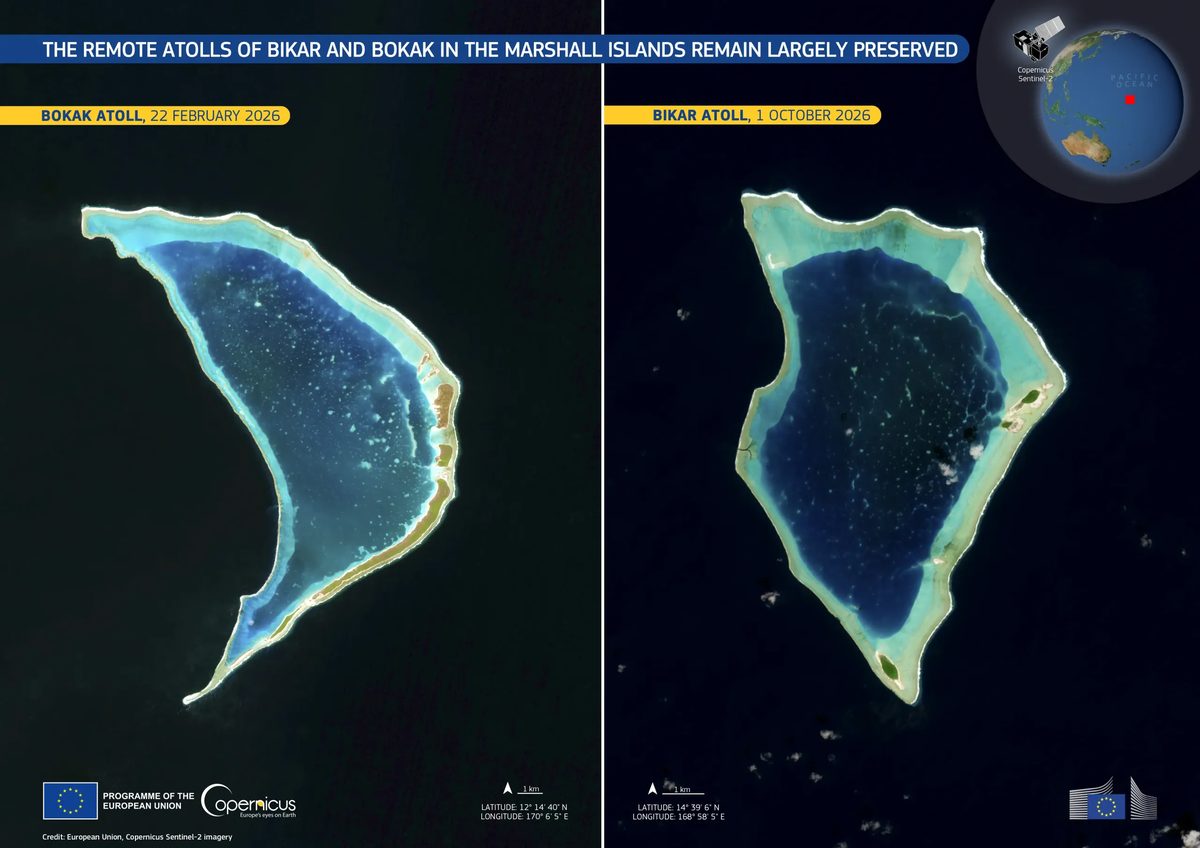
In January 2025, the Marshall Islands banned fishing across 48,000 square kilometers around Bikar and Bokak, two uninhabited atolls in the northern Pacific. A study published Nov. 11, 2026, gives the first detailed ecological baseline of the sanctuary.

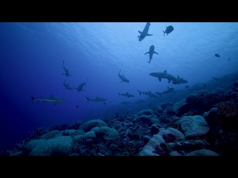
The survey found 15 seabird colonies, 266 groups of reef fish and 132 green turtle nest pits at Bikar. The atolls are not literally untouched: the study calls them among the most intact ecosystems in the region, and warming water threatens the reefs.

Why it matters

The survey offers a rare baseline for a Pacific reef with little fishing, helping scientists measure what protection can restore elsewhere.

Questions about this story

Free account needed to ask — your question is kept and asked for you right after sign-up. Answers are public.

No questions yet — be the first to ask.

Key Indicators

48,000 sq km
Sanctuary area
Fully protected waters around Bikar and Bokak, declared in January 2025.
15
Seabird colonies
Confirmed or likely breeding colonies across the two atolls.
266
Reef fish groups
Distinct groups recorded in shallow reef surveys.
132
Green turtle nest pits
Nesting was almost entirely concentrated at Bikar.
2
Possible new species
Fish groups that may be new to science, pending formal description.

Voices

Curated perspectives — historical figures and your fellow readers.

Sign up to generate historical perspectives on this story.

People Involved

Organizations Involved

Timeline

2023 November 2026

4 events Latest: Today
Tap a bar to jump to that date
  1. Good News Network reports study findings

    Today Media

    The report summarizes the November 11 study for a general audience.

  2. First comprehensive ecological baseline published

    Research

    The study reports 15 seabird colonies, 266 reef fish groups and two fish groups that may be new to science.

  3. Marshall Islands creates first marine sanctuary

    Policy

    The Marshall Islands declares its first national marine sanctuary, fully protecting 48,000 square kilometers around the two atolls.

  4. Joint expedition surveys the atolls

    Research

    National Geographic Pristine Seas and MIMRA survey Bikar and Bokak from land, sea and sky, including depths to 2,340 meters.

Scenarios

1

Marshall Islands designates a second national marine sanctuary

Possible Resolves by End of 2028

Discussed by: President Hilda Heine said the first sanctuary 'certainly won't be its last,' according to ICRI.

The Reimaanlok framework is community-led, and the government has signaled more protections could follow. A second designation would require a new area, a formal government act and a management plan.

2

Scientists formally describe a new fish species from Bikar or Bokak

Possible Resolves by End of 2030

Discussed by: Alan Friedlander and co-authors reported two fish groups that may be new to science, according to Phys.org.

The 2026 survey recorded 14 fish groups not previously seen in the Marshall Islands. Two could be new species, but formal description requires specimens, genetic work and peer review.

3

Coral bleaching is documented at Bikar or Bokak

Uncertain Resolves by End of 2028

Discussed by: Smithsonian Magazine reported that warming water and disease threaten the reefs.

The sanctuary bans fishing, but it cannot block marine heatwaves. A documented bleaching event would test the claim that intact reefs recover quickly.

Historical Context

3 moments from history that rhyme with this story — and how they unfolded.

June 2006

Papahānaumokuākea Marine National Monument (2006)

President George W. Bush designated the Northwestern Hawaiian Islands monument in June 2006. President Barack Obama expanded it in 2016 to about 1.5 million square kilometers.

Then

Commercial fishing was phased out, and the monument became a UNESCO World Heritage Site in 2010.

Now

It became a reference for large Pacific marine protected areas and long-term ecological monitoring.

Why this matters now

It shows how a remote Pacific archipelago can be protected at scale, and why baseline surveys matter for later comparison.

2008

Phoenix Islands Protected Area (2008)

Kiribati established the Phoenix Islands Protected Area in 2008 and closed it to commercial fishing in 2015. The area covers about 408,000 square kilometers.

Then

It became a UNESCO World Heritage Site in 2010.

Now

Enforcement and funding remained difficult, but the area became a test case for large no-take zones in small island states.

Why this matters now

A small Pacific country used a large no-fishing zone to protect remote atolls, much as the Marshall Islands has done.

April 2010

Chagos Marine Protected Area (2010)

The United Kingdom declared a 640,000-square-kilometer marine protected area around the Chagos Archipelago in April 2010 and banned fishing.

Then

A tribunal found the designation unlawful in 2015 because Britain had not consulted Mauritius.

Now

The sovereignty dispute continued and fed a case at the International Court of Justice.

Why this matters now

It shows that a remote no-take zone can be legally contested when sovereignty is disputed; Bikar and Bokak sit within recognized Marshall Islands territory.

Sources

(4)