
Pull to refresh
Logo
Doomsday Glacier melting faster than projected, doubling sea level estimate

Doomsday Glacier melting faster than projected, doubling sea level estimate

New Capabilities

New model of warm seawater seeping under Thwaites glacier raises its 2100 sea level contribution to 30mm

Yesterday: New model doubles Thwaites sea level projection

Overview

Updated 1 hour ago

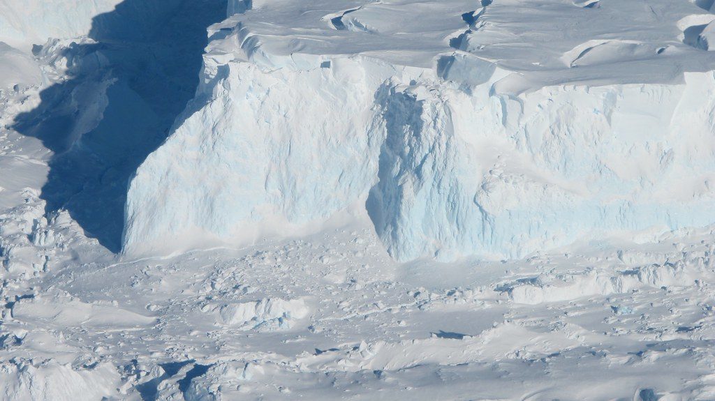
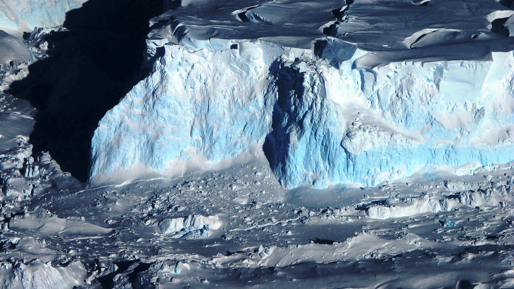
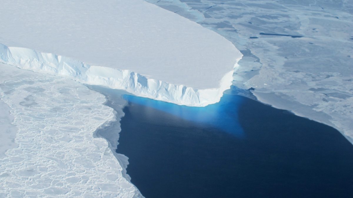
Thwaites glacier — the widest on Earth, roughly the size of Senegal — melts from below as warm seawater pumps underneath it. A new model of that process doubles the amount of sea level rise the glacier is projected to add by 2100.

The model, published in Nature Communications by researchers at the University of California, Irvine and NASA's Jet Propulsion Laboratory, finds Thwaites could contribute 30mm (1.2 inches) to global sea level by 2100 even if warming stops. That is twice the previous estimate. The glacier already drives about 4% of global sea level rise, losing roughly 50 billion tonnes of ice per year.

Why it matters

Thwaites holds enough ice to raise sea levels more than 2 feet, and it pins back a far larger ice sheet behind it.

Questions about this story

Free account needed to ask — your question is kept and asked for you right after sign-up. Answers are public.

No questions yet — be the first to ask.

Key Indicators

30mm
Projected sea level rise from Thwaites by 2100 — double prior estimate
Even with no additional global warming. The old estimate was around 15mm.
60%
Chance Thwaites unpins from Mouginot Ridge by 2100
Unpinning would let the glacier retreat quickly down sloping bedrock toward the next ridge.
4%
Thwaites' current share of global sea level rise
The glacier has lost more than 1,000 billion tonnes of ice since 2000.
50 billion tonnes/yr
Annual ice loss rate
Ongoing loss driven by warm ocean water melting the glacier from beneath.

Voices

Curated perspectives — historical figures and your fellow readers.

Ever wondered what historical figures would say about today's headlines?

Sign up to generate historical perspectives on this story.

People Involved

Organizations Involved

Timeline

3 events Latest: Yesterday
  1. New model doubles Thwaites sea level projection

    Latest Research

    Study incorporating a wide grounding zone with tidal pumping finds Thwaites could add 30mm to sea level by 2100 — twice prior estimates — even without further warming.

  2. Grounding-zone model published in Nature Communications

    Publication

    UC Irvine and NASA JPL researchers publish an ice-sheet model that treats the grounding line as a miles-wide zone where tides pump warm seawater deep under the ice.

  3. Separate modeling shows Thwaites retreat is locked in

    Research

    A second study finds Thwaites will continue losing ice for at least 150 years even if ocean melting stops entirely, though the rate of loss would slow.

Scenarios

1

Under-ice sensors confirm Thwaites tidal pumping

Likely Resolves by End of 2028

Discussed by: Study authors Mattia Poinelli and Eric Rignot; independent expert Robert Larter of British Antarctic Survey

Researchers agree the environment beneath Thwaites is hard to reach and the model lacks direct confirmation. If drilling or seafloor sensors document warm seawater intrusion at the grounding zone, the doubled projection gains strong support.

2

International ice-sheet models adopt the grounding-zone approach

Possible Resolves by End of 2030

Discussed by: Eric Rignot and the broader glaciology community

If the new grounding-zone treatment spreads into the international ice-sheet models that feed the next IPCC assessment, global sea level projections would rise accordingly. This depends on replication and acceptance by other modeling groups.

3

Satellites detect accelerating unpinning from Mouginot Ridge

Possible Resolves by End of 2032

Discussed by: Study authors and NASA satellite monitoring programs

The study puts a 60% chance that Thwaites unpins from Mouginot Ridge by 2100. Continuous satellite tracking could show the grounding line retreating faster than its historical trend well before mid-century, providing an early warning signal.

Historical Context

2 moments from history that rhyme with this story — and how they unfolded.

February-March 2002

Larsen B ice shelf collapse (2002)

The Larsen B ice shelf on the Antarctic Peninsula, an area roughly the size of Rhode Island, disintegrated into thousands of icebergs over about five weeks. Satellite images showed the shelf shattering after decades of warming and surface meltwater flooding its crevasses.

Then

Glaciers behind the shelf accelerated their flow into the ocean several-fold within months, showing how quickly ice can respond when a floating barrier is removed.

Now

The collapse became the benchmark case for rapid, non-linear ice-sheet response, and it surprised scientists who had assumed such disintegration took centuries.

Why this matters now

Like Thwaites today, Larsen B showed Antarctic ice can change faster than models projected. The new Thwaites research extends that lesson to a far larger glacier with global sea level consequences.

1990s-2010s

Jakobshavn Isbræ glacier acceleration (Greenland, 2000s-2010s)

Jakobshavn Isbræ, Greenland's fastest-flowing glacier, doubled its flow speed over roughly a decade as warm ocean water melted the base of its floating tongue. The glacier's front retreated more than 20 kilometers inland.

Then

The meltwater it discharged into the ocean drew global attention and became the Greenland ice sheet's single largest contributor to sea level rise.

Now

Monitoring continued to show it can re-advance when ocean temperatures cool slightly, evidence that some glaciers respond to forcing changes while others do not.

Why this matters now

Jakobshavn shows ocean-warming-driven glacier acceleration can be detected and tracked in near-real time. The same satellite tools are now the primary evidence base for measuring Thwaites' ongoing retreat.

Sources

(6)